
From geostationary satellite coordinates to geographic coordinates
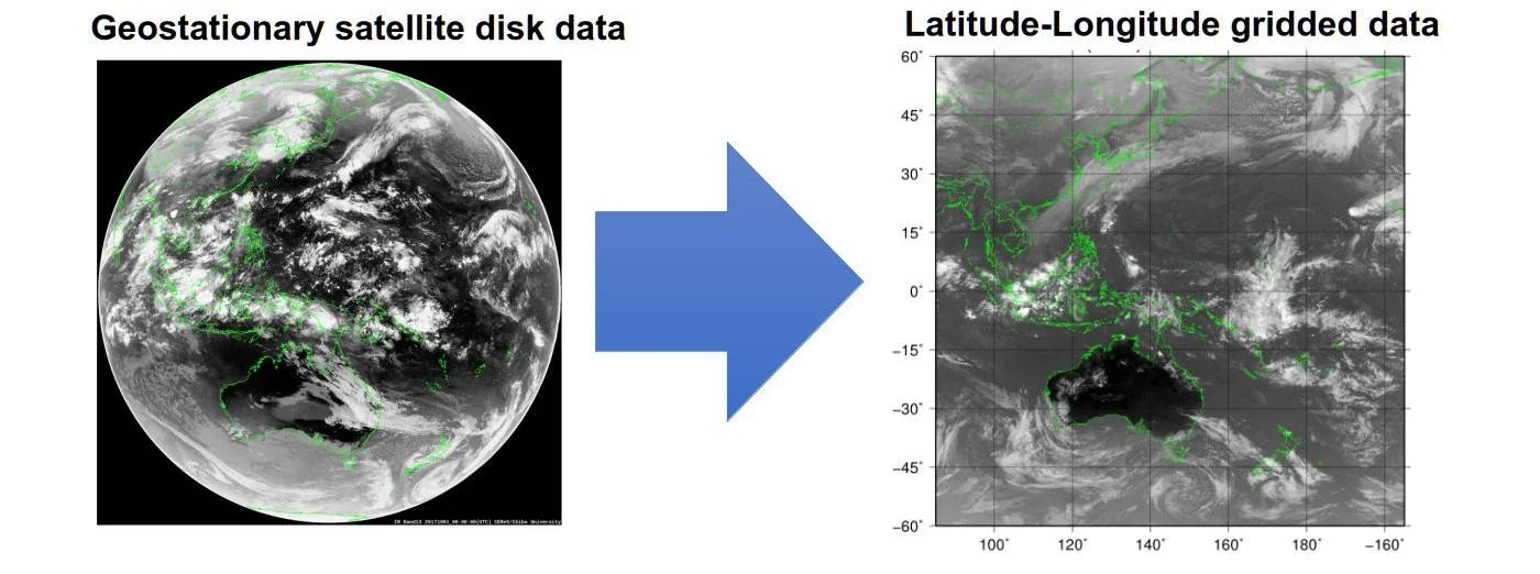
Geostationary meteorological satellites observe Earth from an orbit approximately 35,800 km above the equator. Observed pixels are defined not by latitude and longitude but by satellite-projection coordinates such as scan angle, line, and column. To integrate satellite observations with ground measurements, terrain, meteorological fields, and other geospatial datasets, geographic coordinates must be calculated for each observed pixel.
The transformation uses satellite position, attitude, scan geometry, and an Earth ellipsoid model. Latitude and longitude are obtained from the intersection between each observation line of sight and the Earth ellipsoid.
Pixels are defined by scan angle, line, and column.
Navigation parameters and an Earth ellipsoid model define each observation line of sight.
Geographic coordinates are obtained from the line-of-sight intersection with the Earth ellipsoid.
Navigation errors limit the positional accuracy of geometric projection
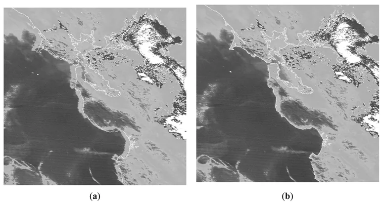
The satellite-projection equations are geometrically defined, but the navigation information supplied to those equations contains errors. Errors in satellite attitude, orbit information, scanning-mirror motion, and related parameters propagate directly into the calculated geographic coordinates. Therefore, transforming satellite-projection coordinates to latitude and longitude using navigation information alone does not provide sufficient positional accuracy for coastlines, islands, and surface landmarks.
AMATERASS developed the Geolocation Correction method to estimate the residual geolocation error remaining after geometric projection and to correct the navigation information using the observed imagery.
Estimating residual geolocation error from observed imagery
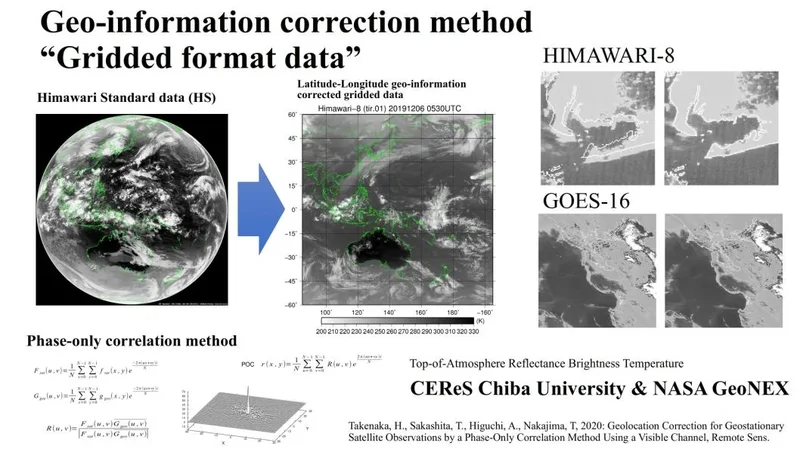
Residual geolocation error is estimated by registering visible-channel observations against geographically referenced landmark images constructed from sources including SRTM 1-arcsecond data. Relative image position is estimated using Phase-Only Correlation (POC). The peak position of the correlation surface obtained from two-dimensional fast Fourier transforms provides the line- and column-direction components of the geolocation error in image coordinates.
For continuous application to high-cadence observations, the error-estimation procedure is parallelized. For Himawari-8 10-minute Full Disk observations, 22,709 points can be processed in about 10 seconds using 88 threads.
Applying the estimated error to the navigation parameters
The line- and column-direction geolocation-error components estimated by POC are retained as observation-specific navigation corrections and propagated into the subsequent geographic-coordinate calculation. The corrections are reflected in the navigation offsets coff and loff, reducing time-dependent variation in the calculated geographic position of the same surface feature.
The corrected navigation information is then applied consistently to the geographic-coordinate calculation for the visible and infrared channels.
Generating latitude–longitude grids from corrected geographic coordinates
After geolocation correction, observed pixels are remapped to a common geographic coordinate system. AMATERASS generates regular latitude–longitude grids at 0.005°, 0.01°, and 0.02° spacing according to native channel resolution. This allows satellite observations to be integrated on the same geographic coordinates with ground observations, meteorological fields, terrain, land cover, and other external datasets.
For validation of satellite-derived quantities such as surface solar radiation, geolocation error is an error source independent of the physical retrieval itself. In time-series analysis, geolocation error can also appear as spurious spatial variability, making consistent geographic coordinates across observation times essential.
From AMATERASS to NASA GeoNEX
Geolocation-correction and geostationary-disk gridding programs developed through AMATERASS-related work were provided to NASA NEX. Following workflow integration and execution by the GeoNEX team, these programs were used in the production of NASA GeoNEX Level 1G products. The geolocation-correction and gridding technology developed for AMATERASS was thus applied to NASA's product generation.
Takenaka, H. et al. (2020), “Geolocation Correction for Geostationary Satellite Observations by a Phase-Only Correlation Method Using a Visible Channel,” Remote Sensing, 12, 2472. doi:10.3390/rs12152472 ↗
Wang, W. et al. (2020), “An Introduction to the Geostationary-NASA Earth Exchange (GeoNEX) Products,” Remote Sensing, 12, 1267. doi:10.3390/rs12081267 ↗