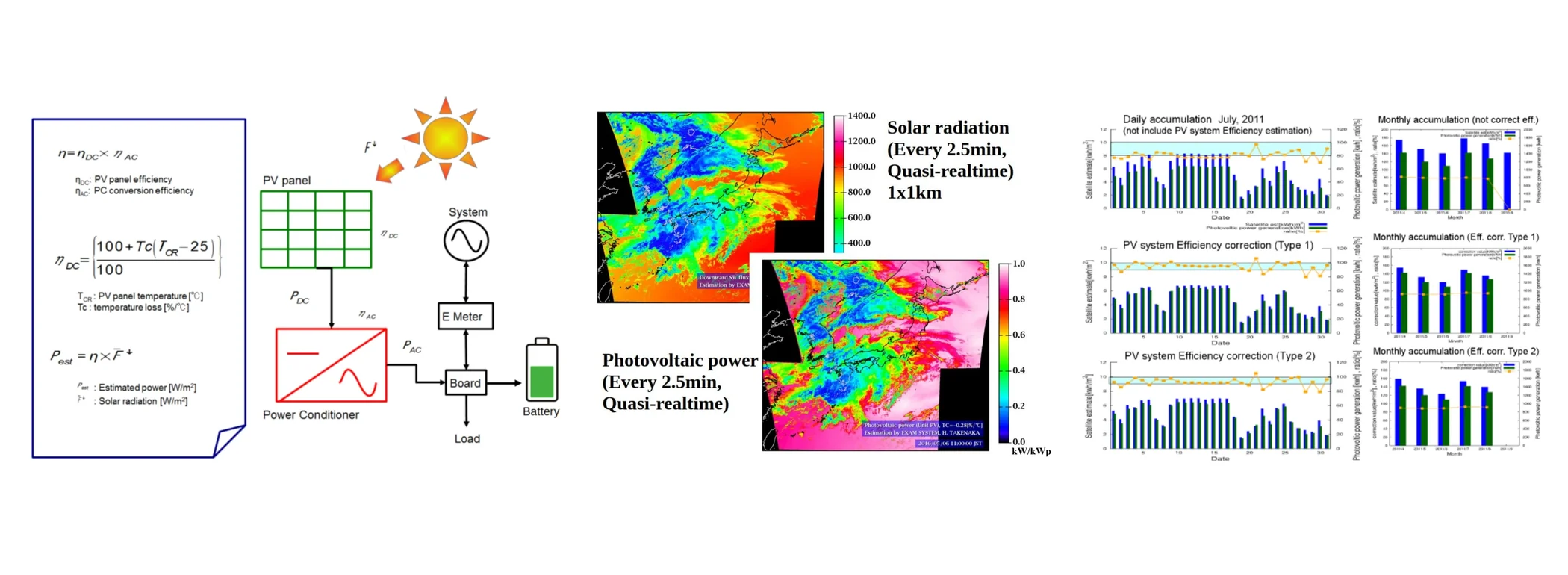
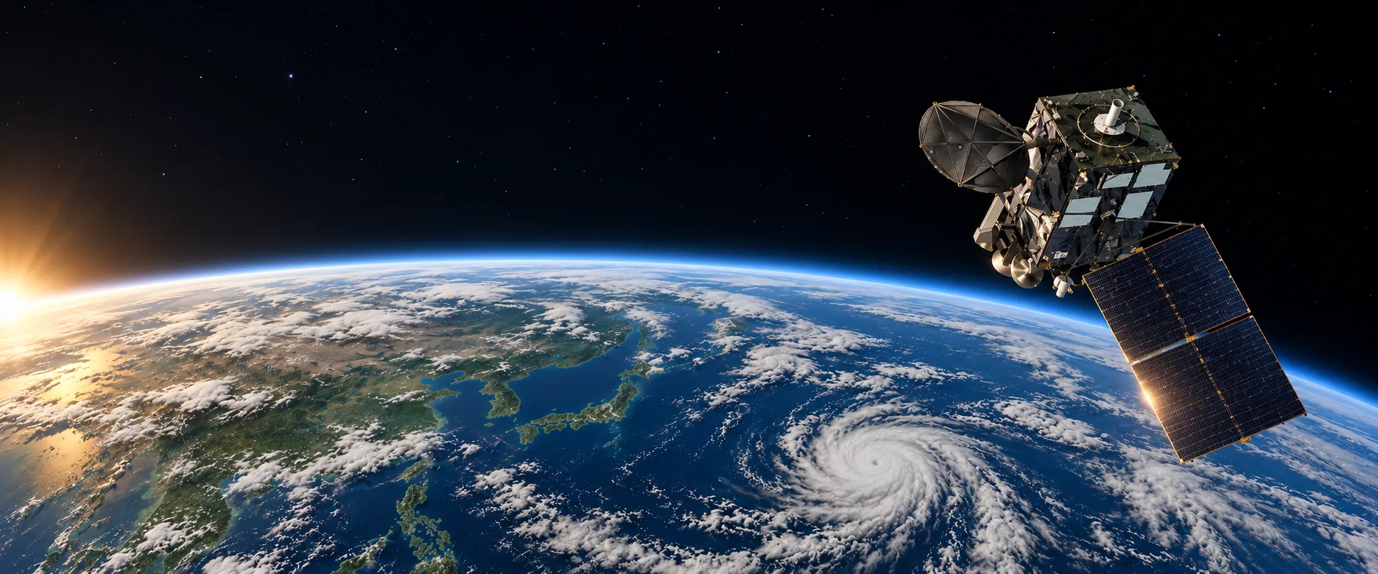
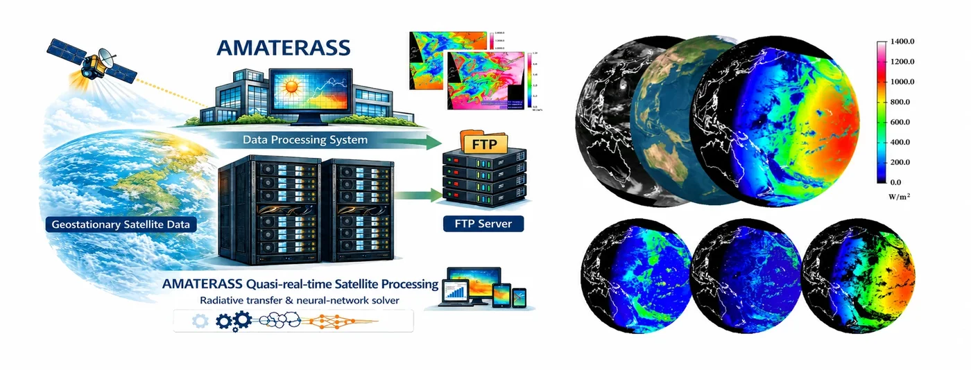
AMATERASS is a system that physically analyzes observations from geostationary satellites to estimate, in quasi-real time, quantities such as solar radiation reaching Earth’s surface. Rather than empirically converting image brightness, it analyzes how solar radiation travels through the atmosphere based on radiative-transfer calculations. It accounts for absorption and scattering associated with atmospheric clouds, ozone, water vapor, and other constituents, and estimates surface radiation from satellite observations. AMATERASS is grounded in research based on ground observations, and began with radiative-transfer calculations and their acceleration by neural networks. It then expanded into calibration of satellite onboard sensors, which allows geostationary data to be used reliably as physical quantities, and into the geolocation correction algorithm and the latitude–longitude grid product generation on which time-series analysis depends. Today it serves as a foundation for the cross-disciplinary use of solar radiation data, from photovoltaic and solar thermal applications to land surface and hydrology, vegetation, social science, and disaster prevention.
Starting from the radiation budget
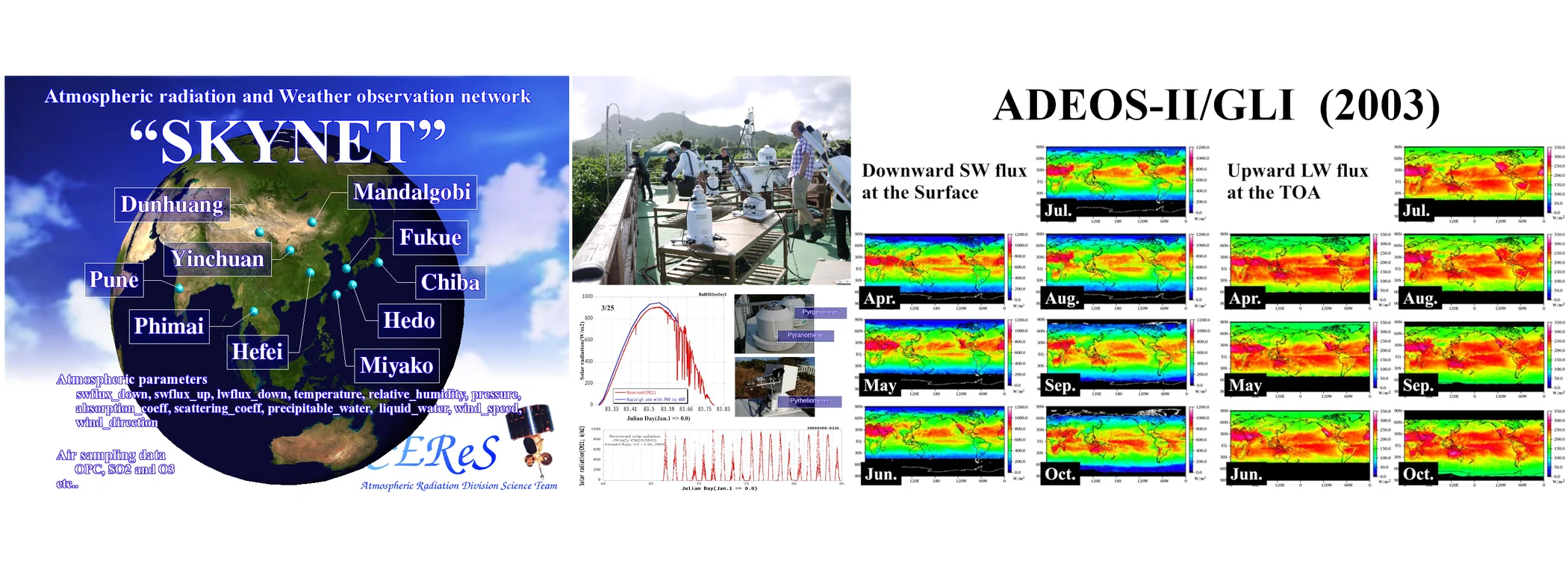
The original goal was to contribute to understanding climate and climate change through observational assessment of the radiation budget. Earth receives solar radiation and warms, while releasing energy into space through infrared radiation emitted by the surface and atmosphere. Atmospheric particles and absorbing gases affect Earth’s energy budget through the absorption and scattering of shortwave radiation and the absorption and re-emission of longwave radiation. Evaluating these effects requires broad, continuous, observation-based estimates of the radiation budget at the top of the atmosphere and at the surface. This line of work began with ground observations and point-scale estimates above the observation sites, and developed step by step into wide-area satellite analysis. Experience gained from field observation with pyranometers, sky radiometers, microwave radiometers and other instruments underpins the satellite retrievals.
Learning algorithms for physical computation and quasi-real-time analysis
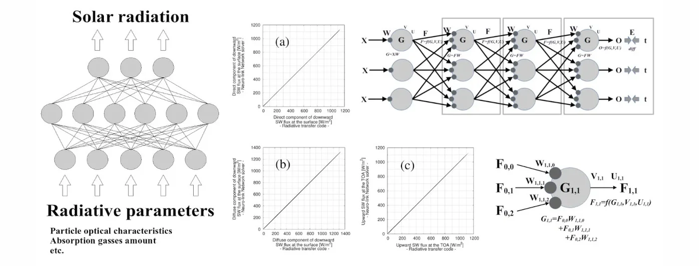
Radiative-transfer calculations can represent detailed physical processes, but continuously analyzing high-frequency, wide-area satellite observations requires substantial computing resources. AMATERASS accelerates analyses based on physical models by training a neural network on the radiative-transfer calculations themselves. Combined with the ability of geostationary satellites to repeatedly observe the same regions, this approach has enabled quasi-real-time analysis over wide areas. The look-up table (LUT) method commonly used in satellite analysis breaks down as the number of parameters grows: database volume and interpolation become rapidly more complex, and the rising computational cost eventually makes the analysis impossible. We therefore developed a learning algorithm that approximates the radiative transfer model to high accuracy while preserving its physical processes, making it possible to estimate solar radiation rapidly from radiative parameters. Raising rigorous but computationally expensive radiative-transfer calculations to a practical speed, one that can keep pace with a high-frequency satellite observation schedule, is the central characteristic of AMATERASS.
From Himawari-5 to the present
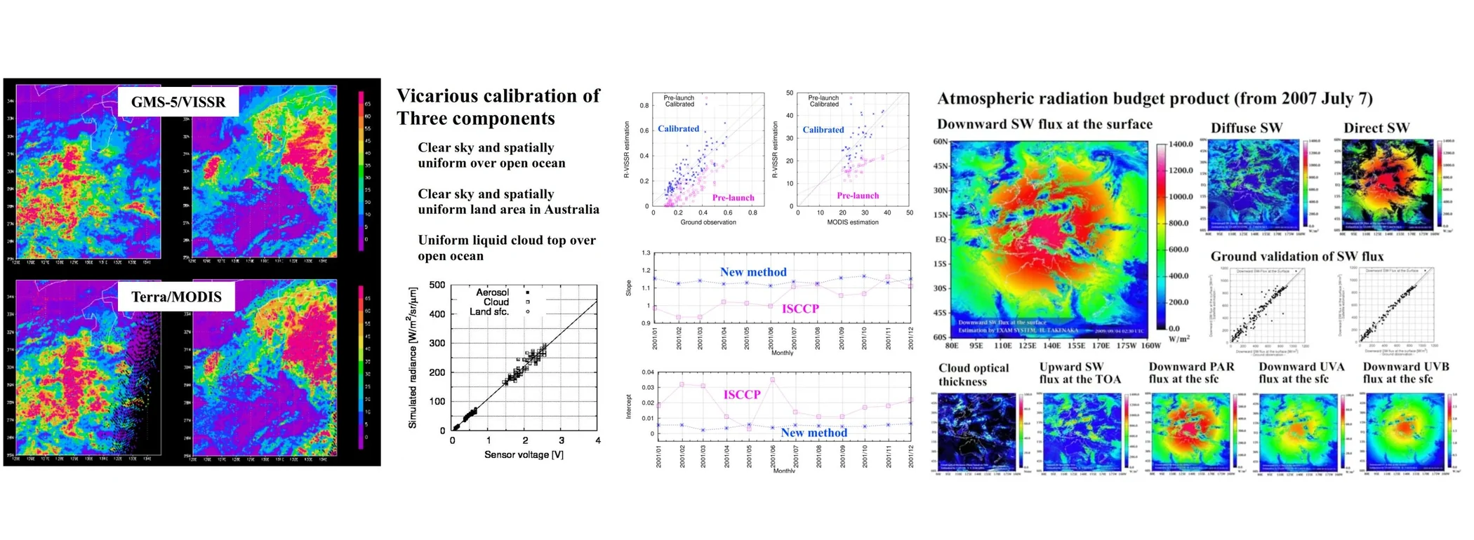
Development began with analyses using observations from Himawari-5. Quasi-real-time analysis and data release began on July 7, 2007, using observations from Himawari-6, and the system has since continued with subsequent satellites. Today, observations from Himawari-8 and Himawari-9 are analyzed quasi-real time at 10-minute intervals over the full disk and at 2.5-minute intervals over Japan. Quasi-real-time analysis has also started for the MSG-IODC observation region. The development of AMATERASS also contributed to calibration techniques for satellite onboard sensors. In joint research with the JMA Meteorological Satellite Center, we helped build a vicarious calibration method for visible sensors using clouds, aerosols and the land surface. JMA proposed this work to the World Meteorological Organization’s GSICS (Global Space-based Inter-Calibration System) as a Japanese satellite calibration technique, and it is used in the vicarious calibration of visible and near-infrared bands, including those of Himawari-8 and Himawari-9.
Interdisciplinary research after the Great East Japan Earthquake
The role of AMATERASS changed significantly following the Great East Japan Earthquake of 2011. Solar radiation analysis, which began for meteorological and climate research, was connected to the estimation of photovoltaic power output in response to requests arising from the electricity supply problems that followed the earthquake, and so came to address questions around renewable energy as well. AMATERASS data were subsequently provided to projects such as JST/CREST and JST/SATREPS, extending into studies of photovoltaic output and power systems. Today, research use has broadened further into vegetation, hydrology, social science, disaster prevention, and other fields that need solar radiation information.